Blog
Map Local Trends in Food Insecurity

Learn More
Understanding the regional and subnational impacts of climate change will be essential to reducing the severity of humanitarian problems as they arise. Environmental impacts on health, sanitation, and nutrition intersect with socioeconomic vulnerabilities that vary significantly from neighborhood to neighborhood.
By mapping existing public health variables associated with vulnerability to specific diseases and combining these human indicators with environmental information, Fraym can provide insight into how the changing environment impacts humans.
Challenge: Malaria’s geographic range is expected to expand with the rise in temperatures allowing mosquitos to persist in new climates.
Solution:
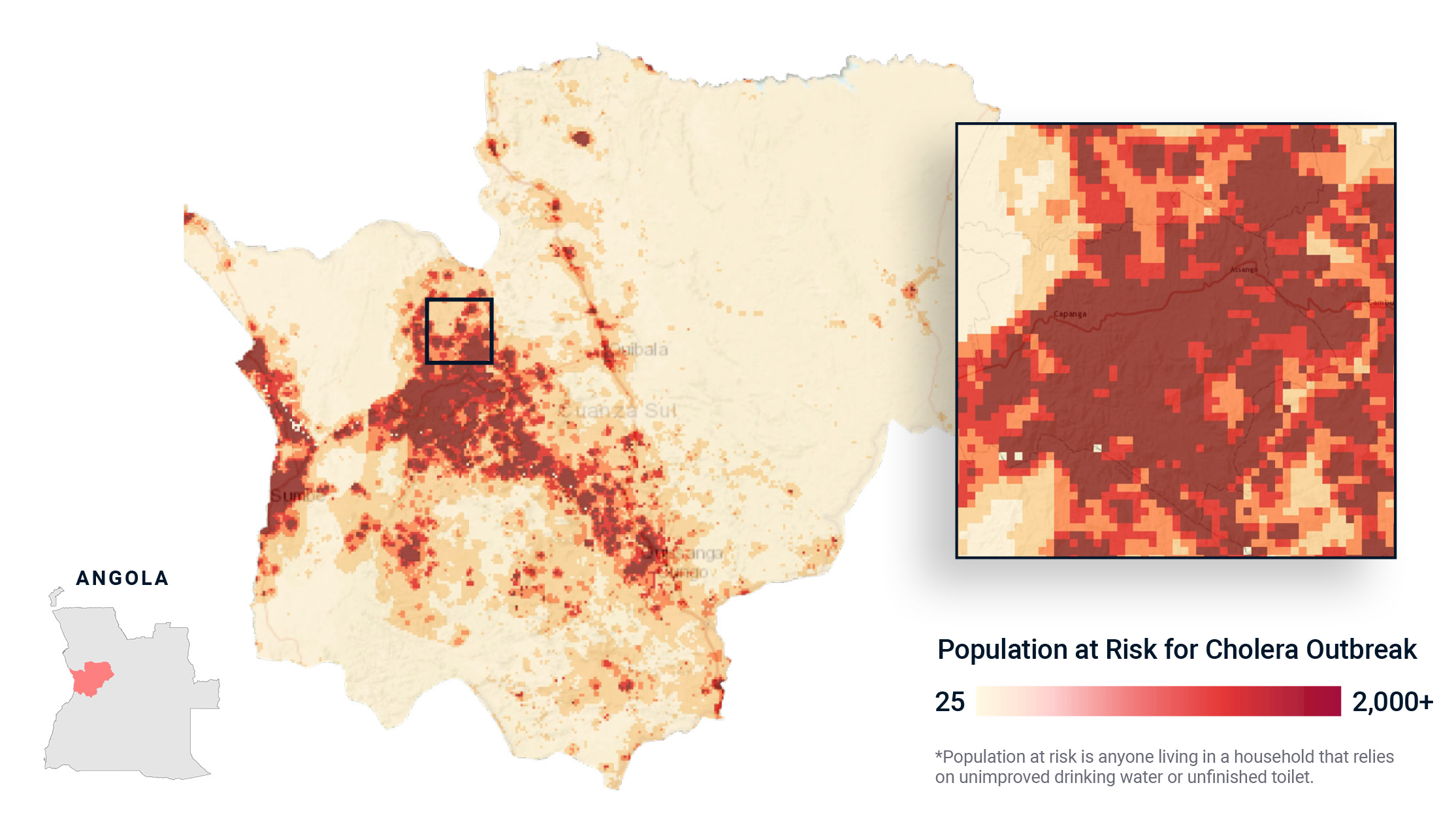
Climate change will increase the frequency and severity of extreme water events, such as drought and flooding. Flooding, in turn, may trigger water-borne disease outbreaks in areas with vulnerable sanitation infrastructure. For example, a flood in Angolan communities where many lack access to improved water sources and a finished toilet would dramatically raise the risk of a cholera outbreak.
Challenge: Increasing migration is already putting strain on cities struggling to maintain sanitation standards in growing informal settlements.
Solution: Neighborhood-level data reveals the spatial nuance of these challenges that policymakers, urban planners, and epidemiologists can leverage to understand the intersection of socioeconomic vulnerabilities and climate shock, and help them answer questions like:
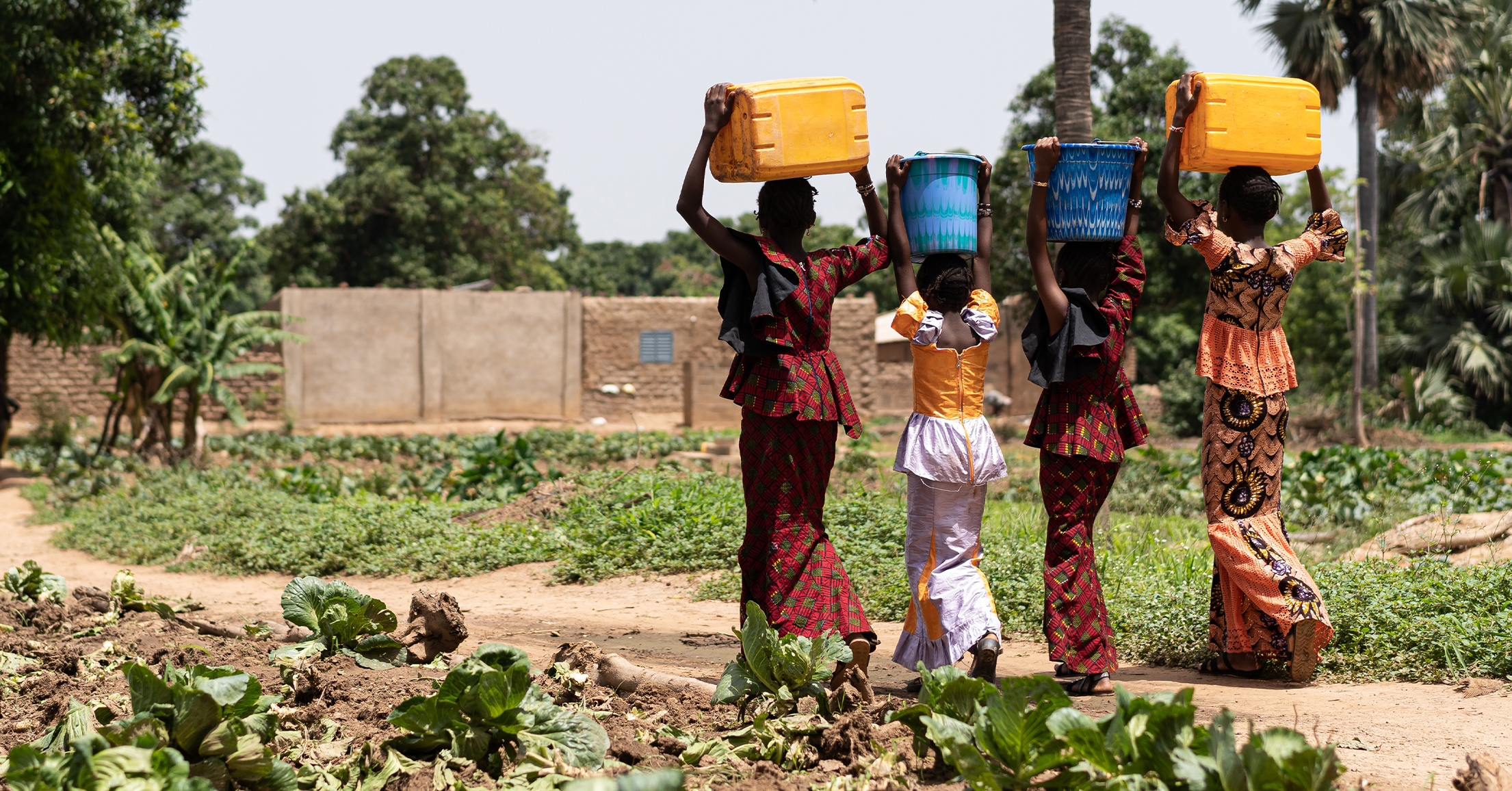
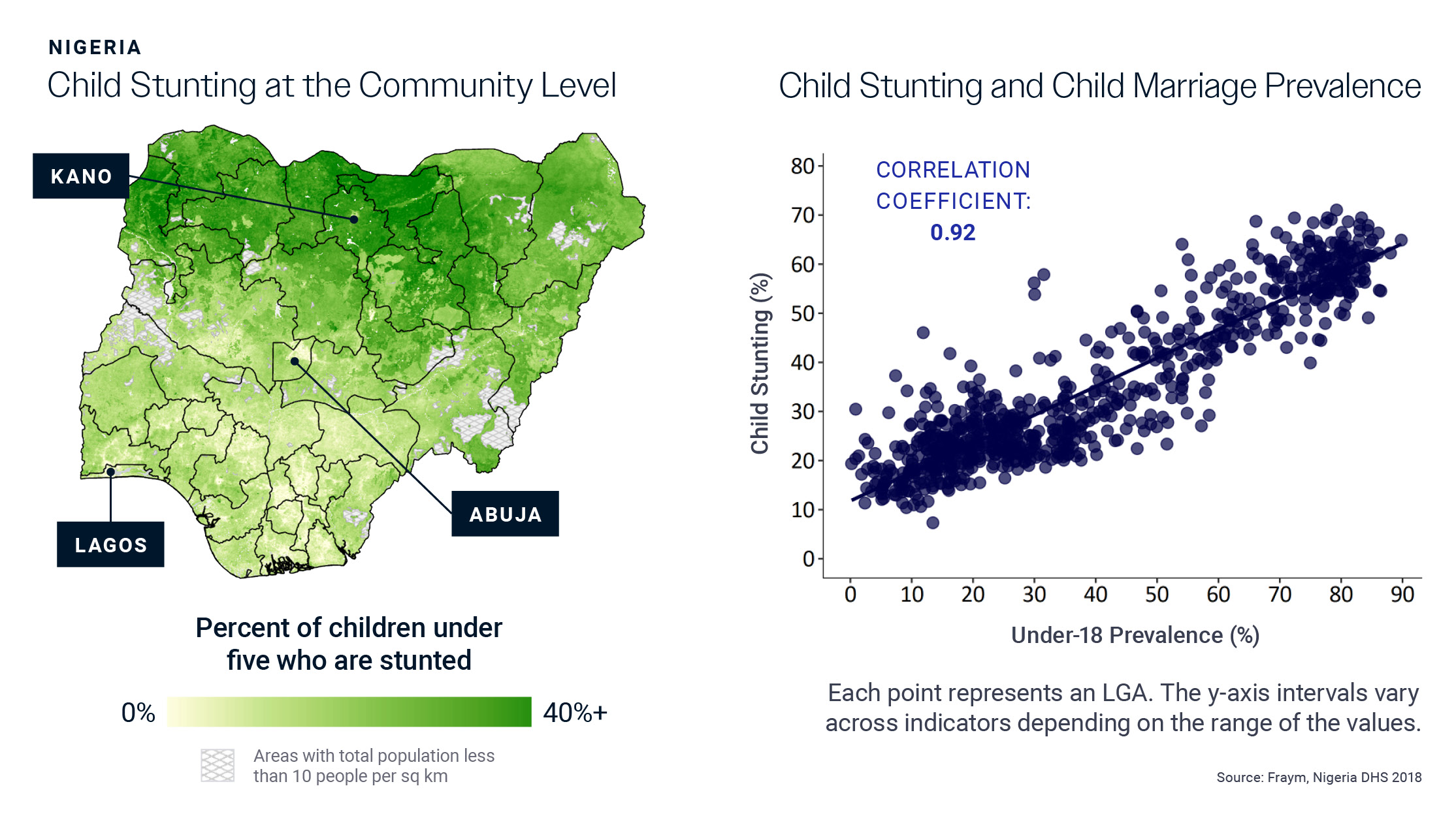
Water scarcity will increase food insecurity.
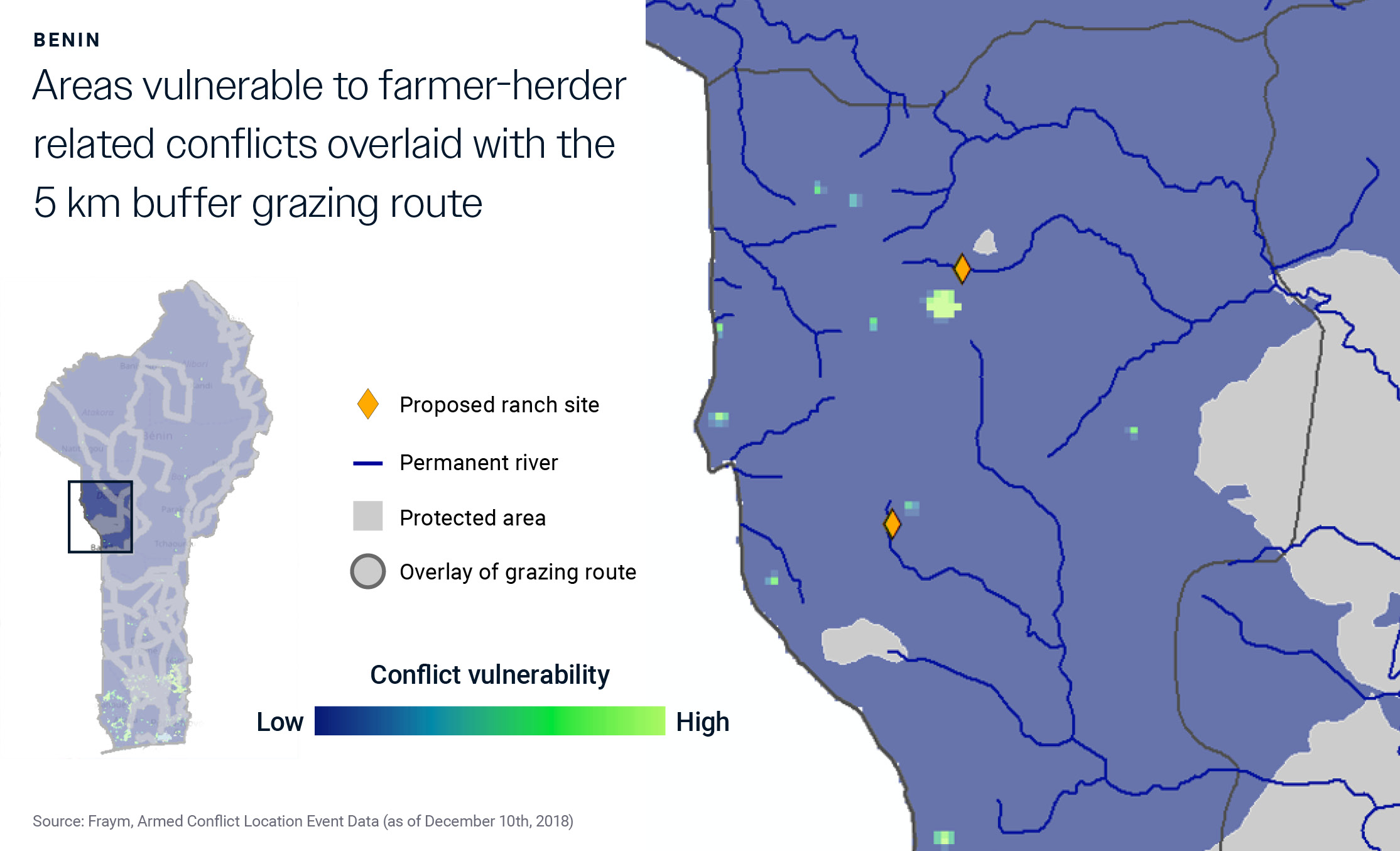
Challenge: Environmental changes will trigger a chain of events in addition to food insecurity, that will require an understanding of nutrition gaps on already vulnerable populations, household decision-making, farmer-herder conflict, and governance.
Solution: Fraym can map where populations have been historically vulnerable and identify trends over time to inform mitigation efforts and humanitarian response in the event of acute needs.
For example:
Climatic change will continue to drive humanitarian challenges, both acute and gradual. Understanding the spatial nuances within and across borders will be an important tool for anticipating, preparing, and mitigating the effects on people. Fraym partners with organizations to mitigate the harmful impacts of rising global temperatures and provide hope to vulnerable communities. With localized data, we can more effectively target and assist those who are most affected and avoid the most disastrous consequences.
