Blog
Addressing the Global Data Crisis With Machine Learning and Hyperlocal Data
Read More

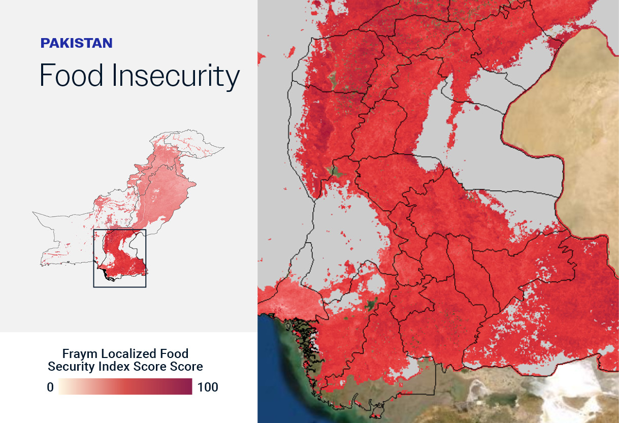
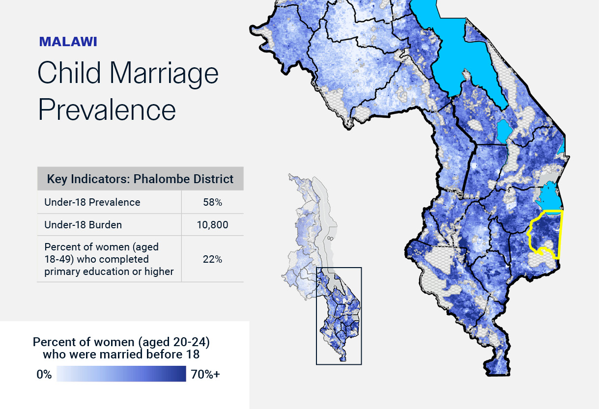
Fraym’s index transforms the latest academic frameworks into actionable heatmaps.
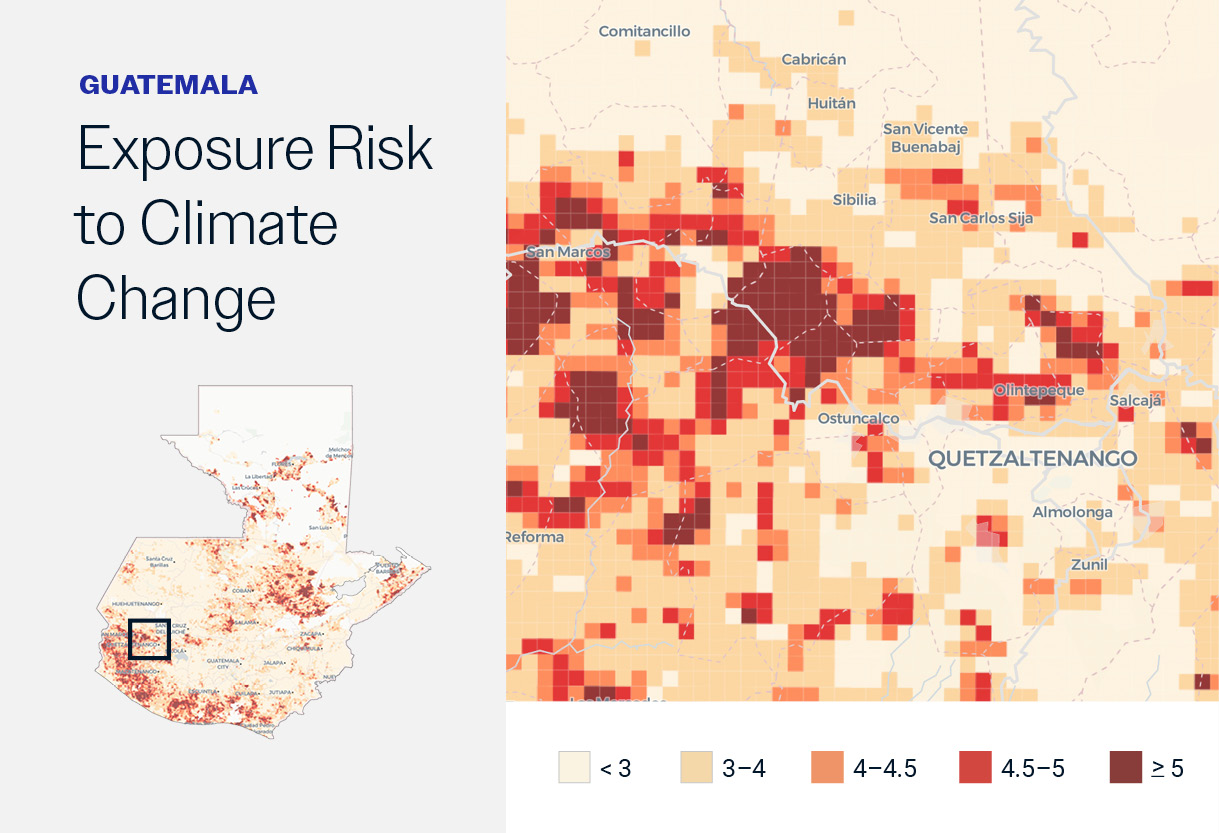
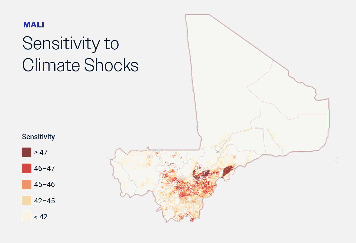
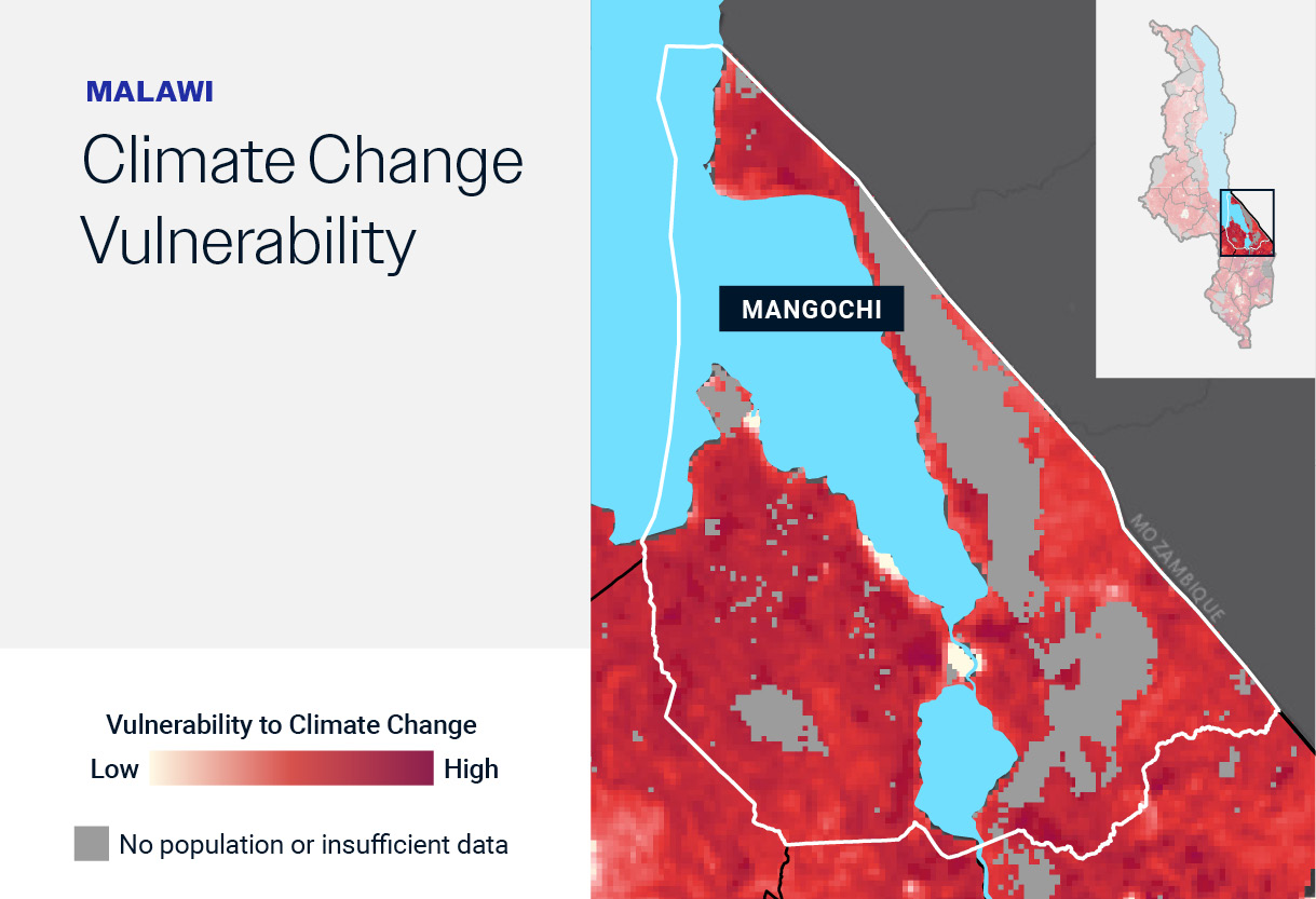
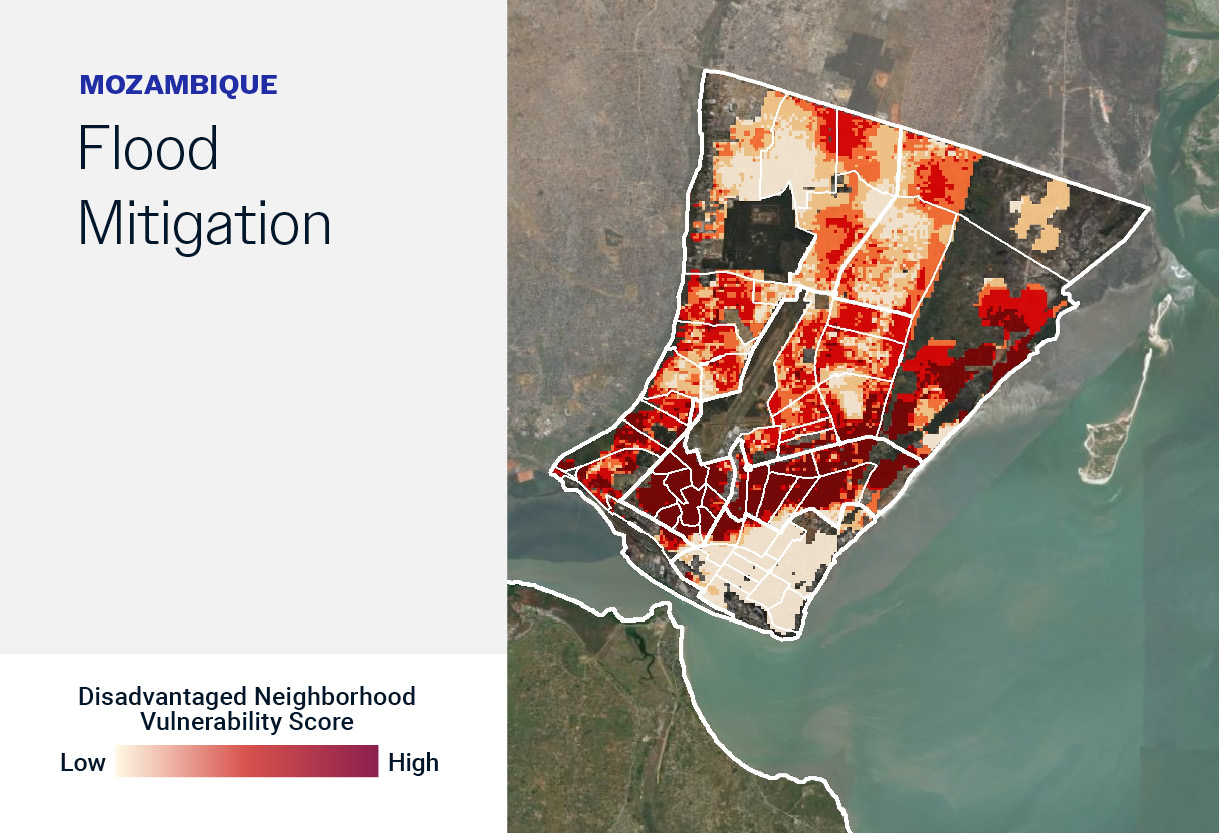
Climate change exacerbates existing development challenges. Fraym unmasks where.
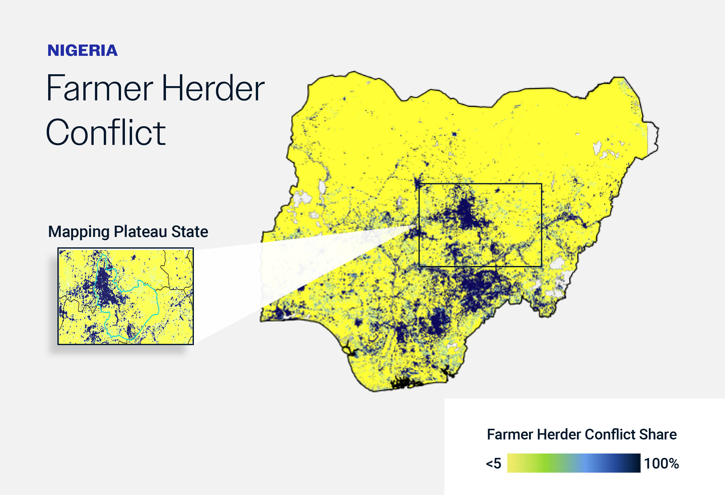
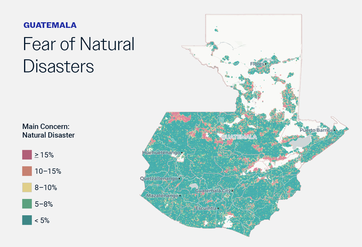
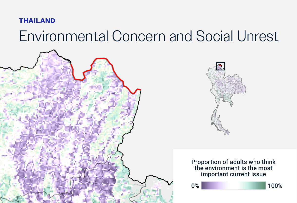
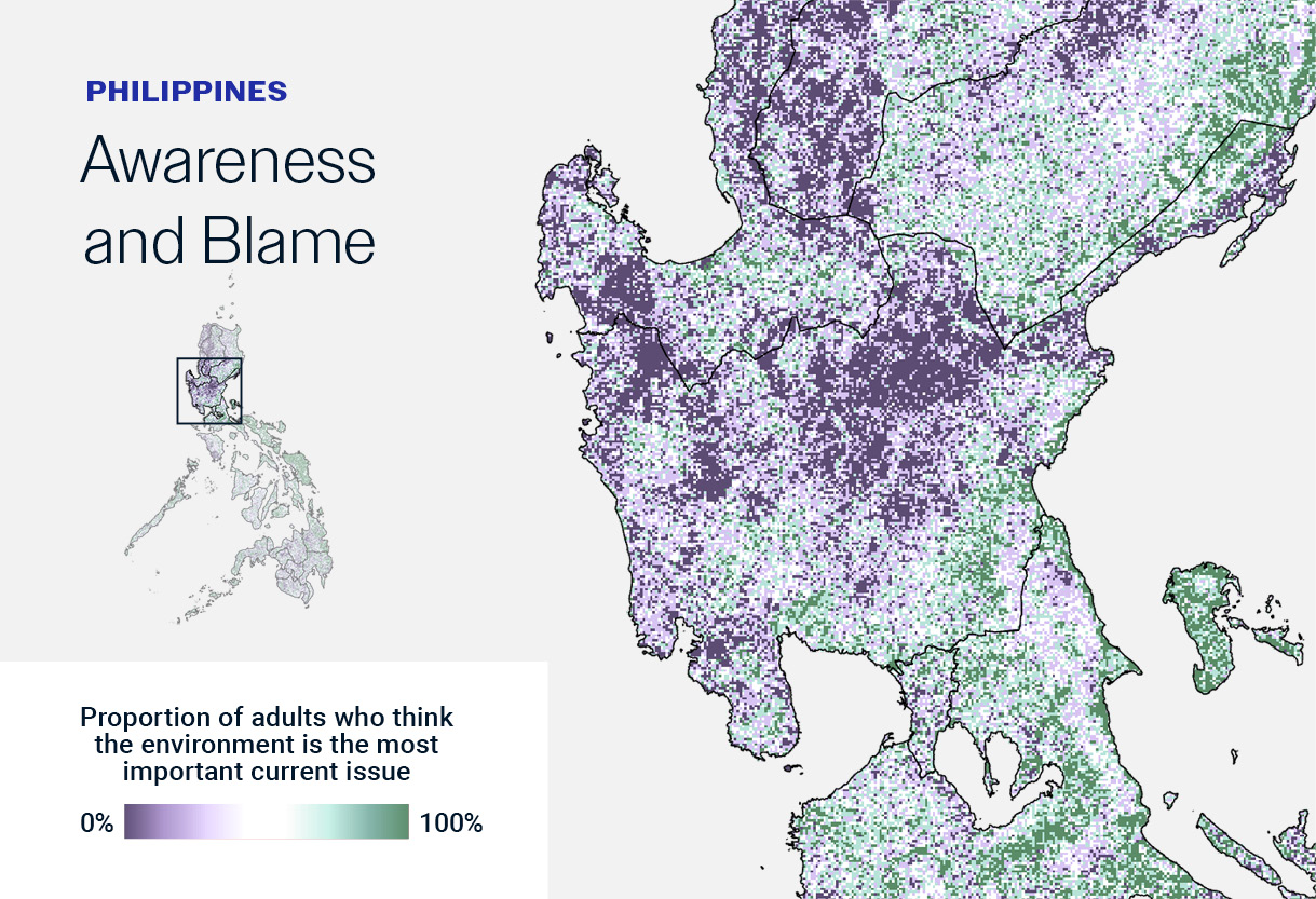
Neighborhood-level data reveals where awareness, concern, and blame are driving people’s decision-making.
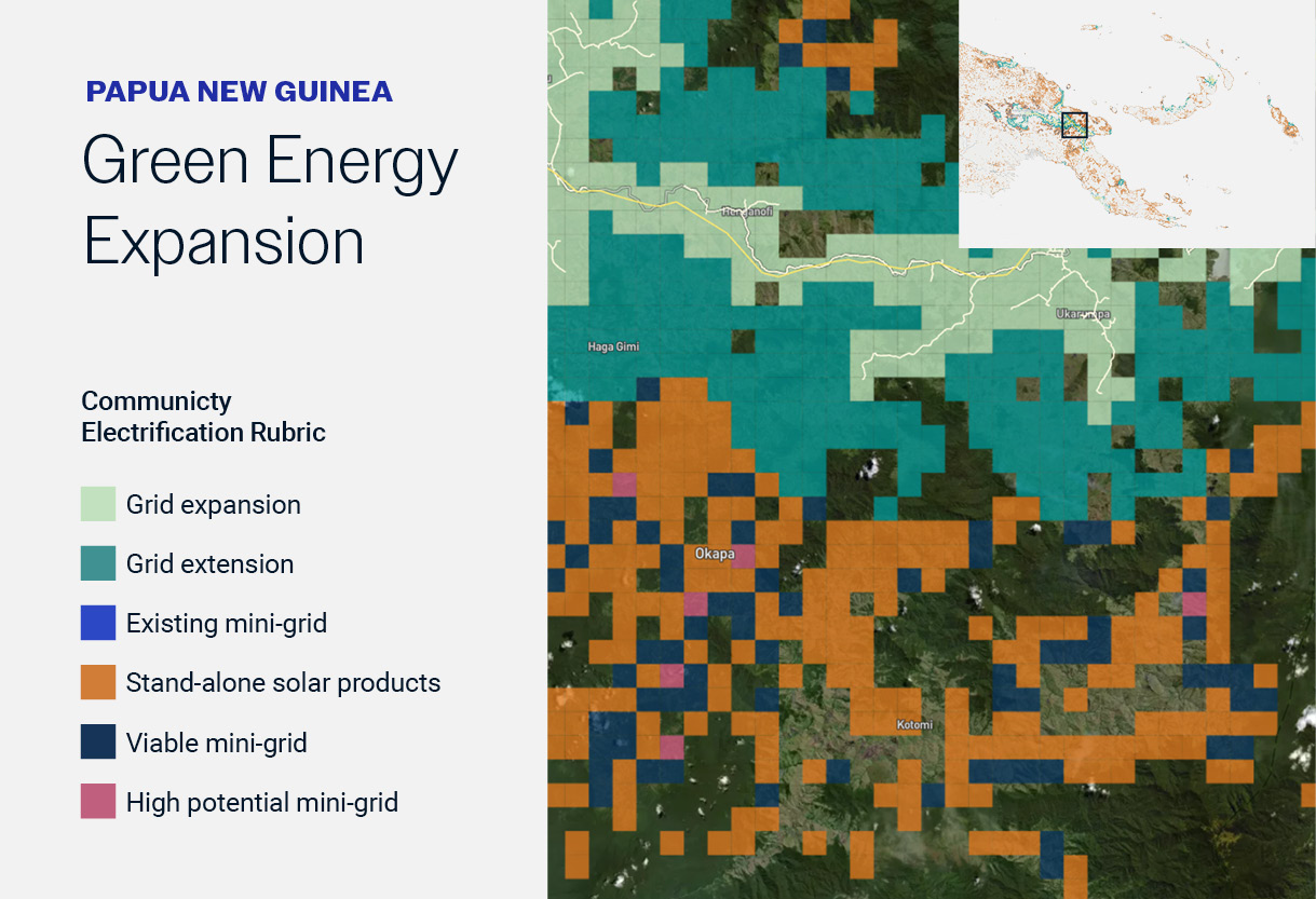
Integrate climate resilience data into strategies to invest in sustainable and equitable infrastructure.
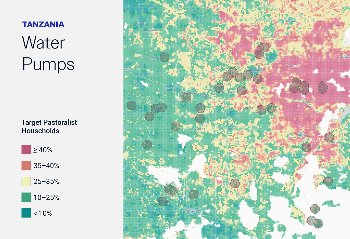

“Fraym’s post L4G program geospatial analysis demonstrates a clear and great ability to provide unique insights.
For example, overlaying the L4G program-sponsored Farmer Field School (FFS) sites with animal vaccination rates gives a clear geographic representation of the FFS sites that have been most effective in facilitating livestock-owning households to bring their cattle, sheep and goats to the sites for vaccination services. This could be used to direct L4G field staff to priority locations.”