Case Studies
Mapping Populations for Vaccine Equity

Learn More
CASE STUDIES
The World Bank collaborated with Fraym on a mapping exercise in Pakistan to identify potential COVID-19 hotspots and facilitate local responses.
The World Bank analysis combined geotagged household survey data (Demographic and Health Survey 2018) with satellite imagery to create localized population information at the level of one-square-kilometer. The highlights three specific examples that can help decision-makers in Pakistan, as well as other data analysts working on similar contexts.
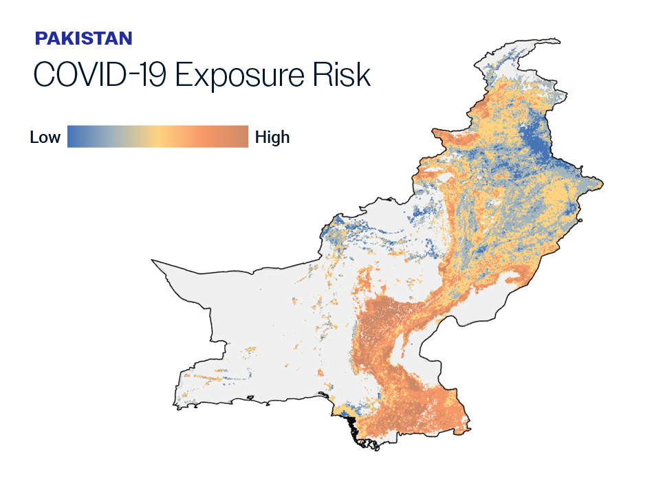
The COVID-19 exposure risk distribution in this map shows that high population density and limited access to basic services in Pakistan translate into high exposure risk for a large share of the population. Zooming in, one notices this is particularly true for communities in Khyber Pakhtunkhwa and Sindh provinces, and for those living in highly populated districts and neighborhoods within these provinces.
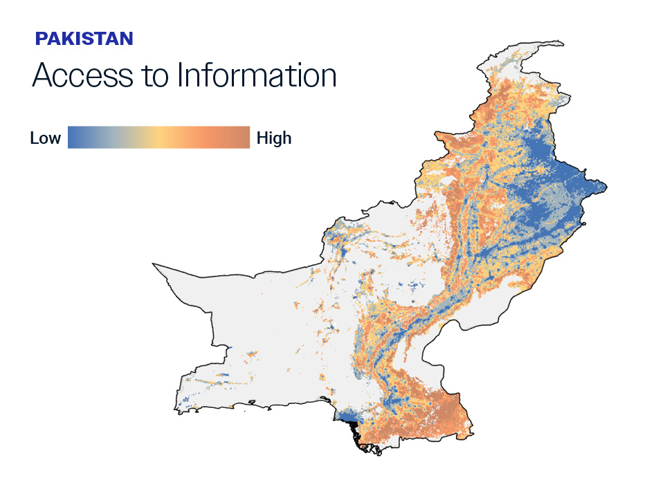
The access to information indicator shows the percentage of the population without a radio, television, or internet or who does not regularly consume these information sources.
Khyber Pakhtunkhwa and Sindh provinces, where the COVID-19 exposure risk is relatively high, seem to have the lowest access to communication channels. Within these two provinces, the southern districts with the highest exposure also have the lowest access to information sources, making them particularly susceptible to disease spread.
Many countries, including Pakistan, have used various dissemination channels to promote mitigating behaviors among their citizens (e.g., television, radio, and digital media). Using high-resolution maps to understand how at-risk populations consume information can inform which communication channels are most appropriate for targeted campaigns.
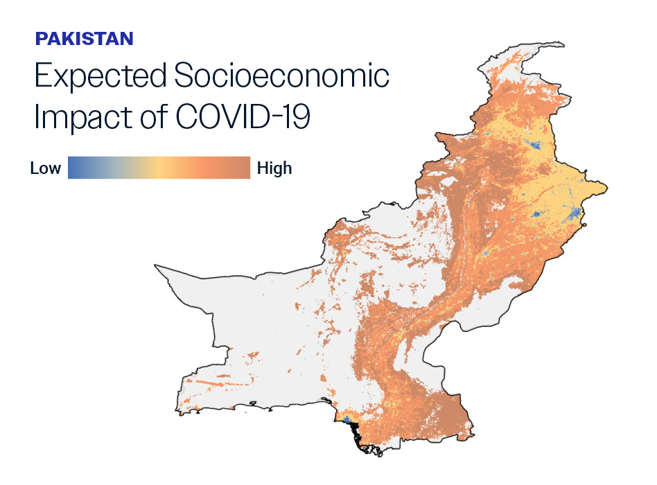
It is important to identify the populations living in areas hit hard by the pandemic to provide targeted support. The socioeconomic impact index shows that the most socioeconomically vulnerable communities in Pakistan are concentrated in southern Punjab, interior parts of Sindh, and most of Khyber Pakhtunkhwa.
In these areas, lockdowns have drastically reduced economic activity and employment. As disease transmission slows down and policy focus shifts to economic recovery, populations living in these areas may be among those who need targeted support.
Evidence shows that living arrangements, exposure to large groups of people, and access to basic sanitation and hygiene contribute to the transmission of COVID-19.
Timely information about recommended protocols and behaviors for containing the disease is crucial.
COVID-19 impacts go beyond immediate public health concerns and can trigger prolonged economic hardship.
%
Households with at least 1 elderly member. above 60
%
Households have no water, soap, or other cleaning agend
%
Have piped drinking water
These high-resolution maps can inform targeted responses to COVID-19. This can be done not only at the provincial or district level, but at the neighborhood level as well. For example, by layering different risk and vulnerability maps, decision-makers can identify nuanced responses and channel their resources to specific areas with the most dire needs.

