Case Studies
Build Effective Social and Behavior Change Strategies
")
Read More
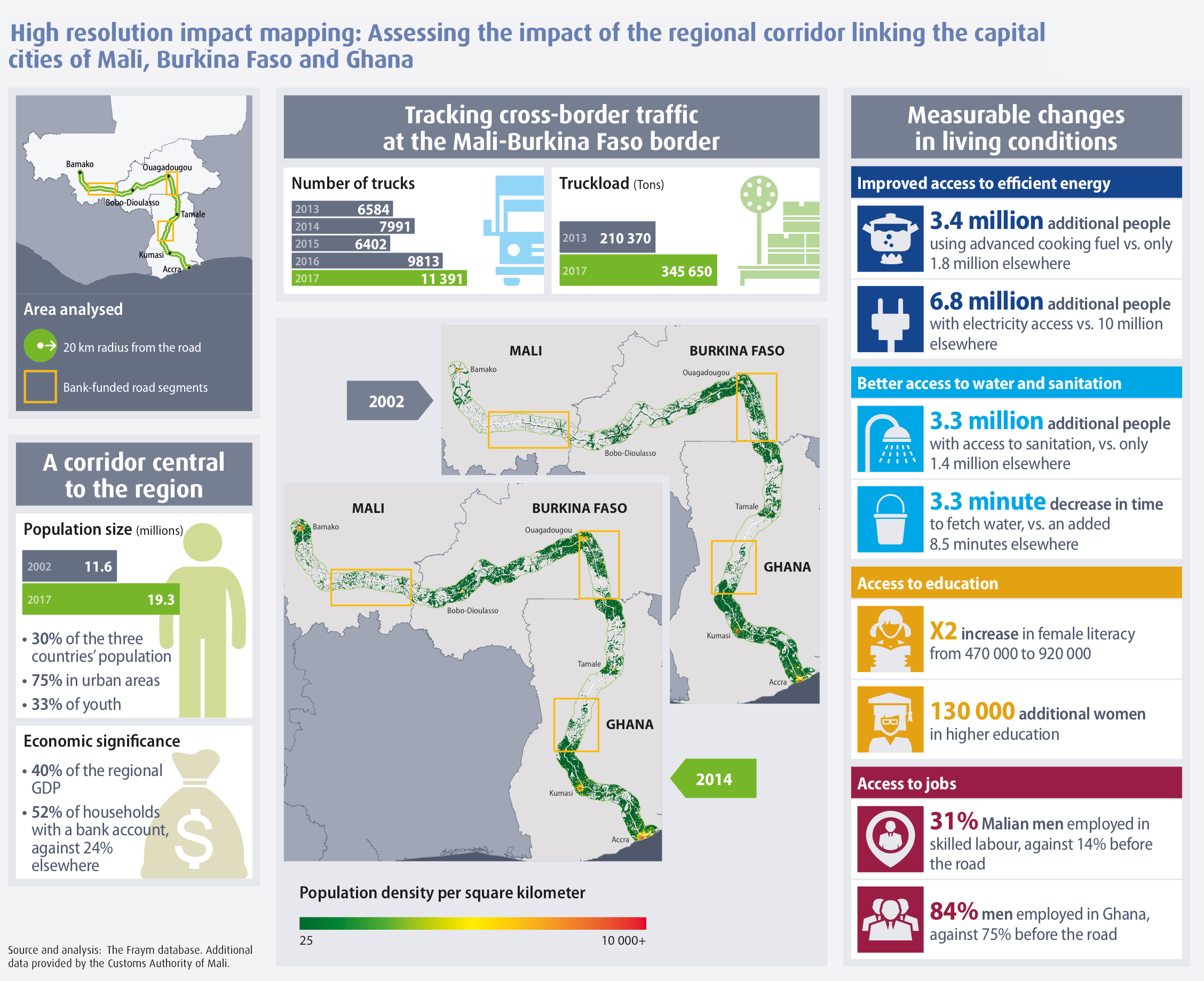
As part of the African Development Bank’s (AfDB) Annual Effectiveness Review (ADER), Fraym used high-resolution time series mapping to examine how lives have changed along a 1900-kilometer road corridor connecting Bamako, Ouagadougou, and Accra. The project was meant to facilitate trade linkages and development. AfDB’s desire to understand livelihood changes within the project area necessitated an innovative approach not limited by administrative boundaries.
Fraym generated a custom polygon that included areas within 20 kilometers of the road, and then used geotagged household survey data from before and after the AfDB-funded road project to analyze changes within the corridor.
Overall, the corridor is home to roughly one-third of the total population of Mali, Burkina Faso, and Ghana. Additionally, the corridor represents about 40 percent of the countries’ GDP.

Though not all changes are directly attributable to the project, some notable results from the before and after analysis inside the corridor include:
Read more about this analysis and other AfDB projects in the 2018 ADER.
By using hyperlocal data, Fraym is helping clients plan more effective projects and assess population changes over time. Our data team can do this for any specialized geography in Africa.

