Case Studies
Build Effective Social and Behavior Change Strategies
")
Read More

Like many other great apes, chimpanzees are endangered. The West African chimpanzee population has declined rapidly, with habitat loss and degradation as major threats. For conservation strategies focused on mitigating risks to chimpanzee habitats, it is critical to understand how current habitats align with pressure from human activity.
Earth Day 2019 emphasizes protecting endangered species like the West African chimpanzee. In honor of the holiday, Fraym partnered with the African Wildlife Foundation (AWF) to map chimpanzee habitats and analyze the risk of habitat loss in southeast Senegal. By combining AWF’s data on chimpanzee locations with Fraym’s expertise in human geography and spatial modeling, this analysis identified places where chimpanzees are likely to live and examined human settlement proximity and possibility of urban expansion.
AWF and partners manually surveyed selected chimpanzee habitats in the southeast region of Senegal over a two month time period. Species surveying is expensive and time-consuming, thus the survey’s coverage is limited. Below shows the AWF survey points versus the area deemed chimpanzee habitat according to the International Union for Conservation of Nature (IUCN).

At Fraym, we can conduct low-cost species modeling by using existing survey data, satellite imagery, and machine learning to estimate chimpanzee habitat in areas that were not surveyed.
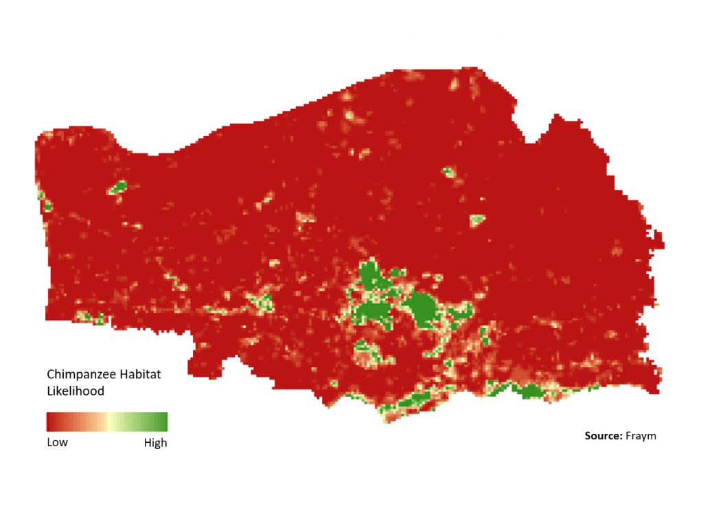
To build upon the work of IUCN, Fraym focused modeling efforts on southeast Senegal. Next, Fraym performed environmental profiling by adding to AWF’s chimpanzee species habitat surveys with remote sensing data on environmental factors as well as Fraym’s socio-demographic data layers. The environmental profiling, in tandem with clustering methods, created a suitable training dataset for Fraym’s machine learning models.
These models are able to distinguish the nuances between the areas with chimpanzees and those without them, and produce a more refined species distribution model. Ultimately, we were able to model areas with similar characteristics as the areas that AWF had already identified as the existing chimpanzee habitat (results shown below).
After identifying likely habitats, Fraym used human settlement and urban expansion data to analyze relevant pressures on chimpanzee habitats in the region. The results from the comparison indicate urban expansion as a notable risk to chimpanzee habitat in this region of Senegal.
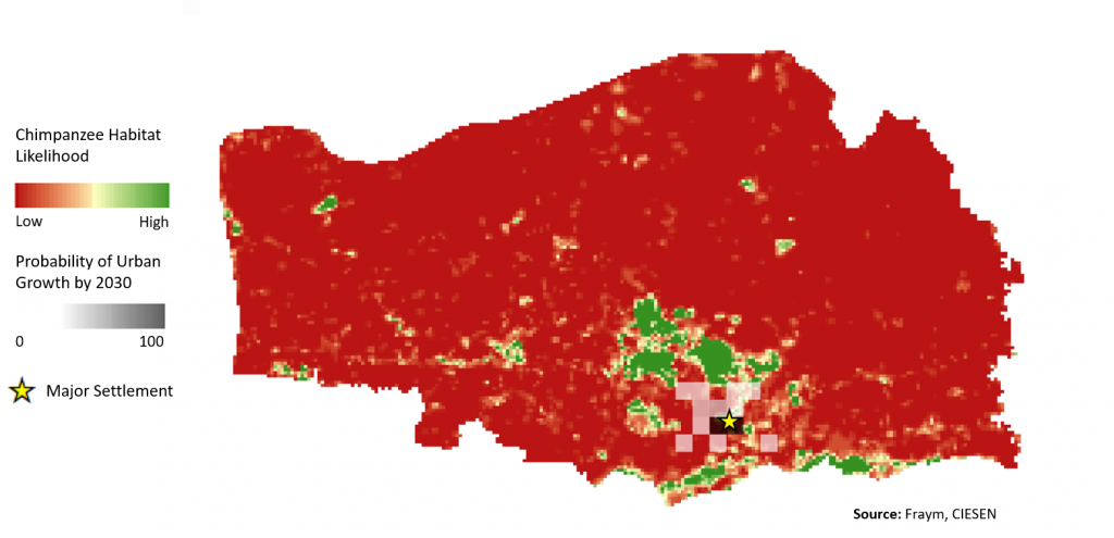
There is currently one major human settlement in this region of Senegal, notably in the core of chimpanzee habitat. The map above highlights the expected urban expansion, with the black and gray grid cells representing the probability of a non-urban area becoming urbanized by 2030. It is clear that significant area in the chimpanzee habitat will be developed in the next decade.
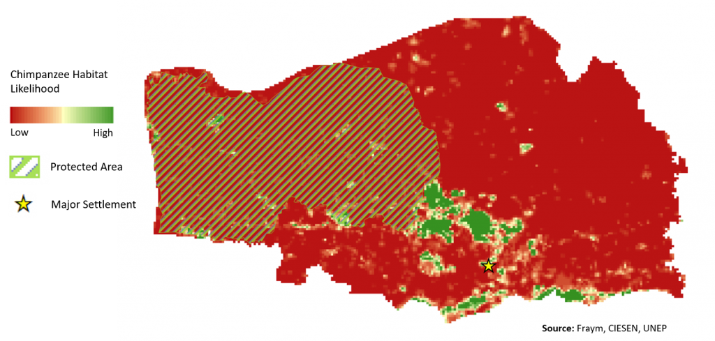
Additionally, a large portion of the chimpanzee habitat falls outside protected areas (as seen in the figure below), highlighting the pressures faced by chimpanzee habitats as communities urbanize. Understanding the dynamics between current species habitat and human geography can aid in both identifying and protecting species, and help to inform actors across all sectors as to how their actions will affect local ecosystems.
As the human population and urban areas continue to grow rapidly, it is important to understand how we can best manage human impact on the environment and non-human communities. Species surveying efforts like those conducted by the African Wildlife Foundation are critical in understanding and mitigating the effects of human activity on wildlife. These collected data paired with innovative methods such as the machine learning approaches conducted at Fraym can help further our understanding the distribution of species such as the endangered chimpanzee and how to better protect them.

