Build Effective Social and Behavior Change Strategies

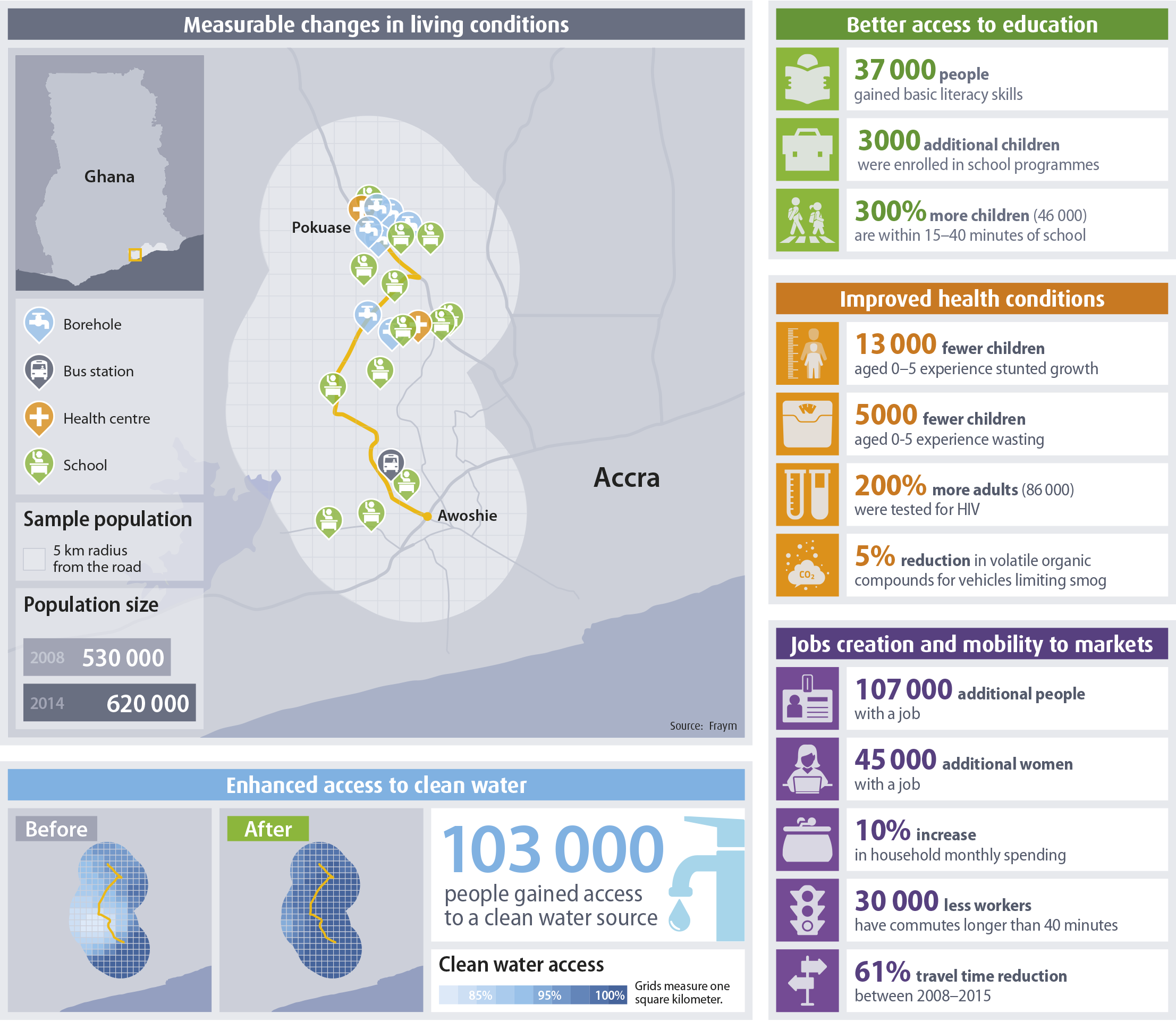
Fraym recently partnered with the African Development Bank’s (AfDB) Delivery, Performance Management and Results Department (SNDR) to map demographic and social changes in communities along a 15-kilometer stretch of the Awoshie-Pokuase Road in Greater Accra, Ghana. SNDR is dedicated to improving the quality and impact of the AfDB portfolio. In pursuit of this goal, they find innovative ways to understand how AfDB projects affect people’s lives. For this year’s flagship Development Effectiveness Review, Fraym and SNDR used frontier geospatial analysis techniques to understand how livelihoods changed in the Awoshi-Pokuase project area.
This road corridor project aimed to improve accessibility, mobility, and market integration both through construction of the road itself, and also through improvements to socioeconomic infrastructure in the area. However, understanding the population in a geographically narrow and specialized road corridor presents a unique challenge. Statistics are only available for areas that are much larger than this immediate construction area, so a more innovative analysis was necessary.
Using geotagged household survey data from before and after the project, Fraym created customized polygons that allowed us to analyze changes in living conditions for people that were inside the project’s focus area—specifically, 5 kilometers from each side of the new road corridor.

While not all changes are directly attributable to the road project, some notable results identified in the before-and-after analysis for the corridor include:
Read more about this analysis and the AfDB’s results in the 2017 Annual Development Effectiveness Review.
By using hyperlocal data, Fraym is helping clients plan more effective projects and assess population changes over time. Our data team can do this for any specialized geography in Africa.